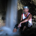
http://www.theregister.co.uk/2010/09/10 ... _backpack/
But can you crawl with it?
Cavechat.org
The Official Caving Forum of the National Speleological Society
NSS Home Page |
Flickr NSS Photo Pool | Online Cavers Network
CaveChat Room |
NSS Bookstore | Find Local Caving Club
Next generation cave mapping
Moderator: Moderators
6 posts
• Page 1 of 1
Next generation cave mapping
![]() by lleblanc » Sep 10, 2010 9:27 am
by lleblanc » Sep 10, 2010 9:27 am
-

lleblanc - Frequent Poster
- Posts: 87
- Joined: Aug 10, 2007 2:19 pm
- Name: Luc Le Blanc
Re: Next generation cave mapping
![]() by Martin Sluka » Sep 10, 2010 10:16 am
by Martin Sluka » Sep 10, 2010 10:16 am
lleblanc wrote:http://But can you crawl with it?
Wait 10 years, Luck! But the description of a cave is not only 3D inner surface, isn't it. ;o)
-

Martin Sluka - NSS Hall Of Fame Poster
- Posts: 402
- Joined: Mar 17, 2006 11:28 am
- Location: Prague, Czech Republic
- Name: Martin Sluka
- NSS #: 29010
Re: Next generation cave mapping
![]() by KeyserSoze » Nov 27, 2010 7:18 pm
by KeyserSoze » Nov 27, 2010 7:18 pm
This is not the first instance of equipment that can achieve 3Dmapping in caves. I know a caver who was on a 3D mapping trip with equipment like this in Mammoth Cave, Kentucky. The equipment that he observed was not attached to a backpack though. It will be interesting to see how this technology improves over the years. One day I will be the old man caver complaining about how easy the modern cavers have it with their new fancy equipment, "in my day we mapped with a compass and tape measure. We had to draw every cave passage. You people these days can do more work in one day than we could do in a year". How sad will it be when the new generation comes along and replaces all of that hard work with such ease.
This signature is really funny
-

KeyserSoze - NSS Hall Of Fame Poster
- Posts: 227
- Joined: Nov 6, 2007 2:18 pm
- Location: Louisville, Kentucky
- NSS #: 61069
- Primary Grotto Affiliation: Louisville Grotto
Re: Next generation cave mapping
![]() by pub » Nov 29, 2010 3:16 am
by pub » Nov 29, 2010 3:16 am
James Rice on SoCal Grotto Yahoo Group wrote:I think cave mapping is about to change radically. Anyone who has surveyed a cave, has wished there were an easier way to do it. Let's imagine a hand-held devise, like a video camera, that would let you map a cave, just as easily as shooting a video. That technology exists. Now if only the price were affordable. It is.
This video is using a laptop computer, and the equivalent of a *$200* Kinect game control camera. Wow.
http://www.youtube.com/user/RGBDvision# ... Rn34pmD5ww
Here's a fly through of (I think) the map made in the video above.
http://www.youtube.com/user/RGBDvision# ... u5Ywwb4RaU
Here they are mapping a single room. Watch the point cloud develop.
http://www.youtube.com/user/RGBDvision# ... 4wXflsoDrY
Balincaguin comes from the Zambal phrase, "Bali lan caguing" meaning "house of bats."
This was the former name of the Municipality of Mabini, Pangasinan, when it was part of the Province of Zambales (of Mt. Pinatubo Volcano fame).
This was the former name of the Municipality of Mabini, Pangasinan, when it was part of the Province of Zambales (of Mt. Pinatubo Volcano fame).
-
pub - NSS Hall Of Fame Poster
- Posts: 296
- Joined: Jun 5, 2009 10:31 pm
- Location: Mabini, Pangasinan, Philippines
- Name: jerry rendon
- NSS #: 61437
- Primary Grotto Affiliation: Balincaguin Conservancy Grotto [Primary] + SoCal Grotto
Re: Next generation cave mapping
![]() by Aaron Addison » Nov 29, 2010 8:10 pm
by Aaron Addison » Nov 29, 2010 8:10 pm
We have been investigating some of these types of technology. Some interesting things are afoot.
Cheers,
AA
Cheers,
AA
------------------------------
Aaron Addison
Stop and ask yourself - "What is this map for?"
Aaron Addison
Stop and ask yourself - "What is this map for?"
- Aaron Addison
- Prolific Poster
- Posts: 180
- Joined: Apr 11, 2006 8:03 am
- Location: St. Charles, MO
Re: Next generation cave mapping
![]() by commanderzoom » Dec 22, 2010 12:42 am
by commanderzoom » Dec 22, 2010 12:42 am
Wow, that thing's enormous!
I don't think I'll be able to learn cave mapping with all this new technology that comes out. I know I can handle the old school compass & tape measure method (just need someone to teach me or a book to read) but using computer programs to create maps? That sounds complicated. I definitely couldn't manage to take something like that beast into a cave without screwing it up--I bet nobody could unless they were in all huge borehole passages. Love to see what the technology for something like that looks like in 20 years, though.
I don't think I'll be able to learn cave mapping with all this new technology that comes out. I know I can handle the old school compass & tape measure method (just need someone to teach me or a book to read) but using computer programs to create maps? That sounds complicated. I definitely couldn't manage to take something like that beast into a cave without screwing it up--I bet nobody could unless they were in all huge borehole passages. Love to see what the technology for something like that looks like in 20 years, though.
- commanderzoom
- NSS Hall Of Fame Poster
- Posts: 287
- Joined: May 28, 2009 5:15 pm
- Location: MO
- NSS #: 61484
- Primary Grotto Affiliation: MVG
6 posts
• Page 1 of 1
Return to Survey and Cartography Forum
Who is online
Users browsing this forum: No registered users
POWERED_BY
 Cavechat RSS Feed
 Cavechat is the official caving forum of the National Speleological Society.
The NSS is not responsible for the opinions expressed, and cannot verify the accuracy of information presented.
Cavechat is the official caving forum of the National Speleological Society.
The NSS is not responsible for the opinions expressed, and cannot verify the accuracy of information presented.