new to caving , trying to decipher this map and was wondering , are cave maps standard as far as their markings?Im having a hard time finding any keys..On this map , what do the arrows mean? , how about the dashed lines,, i can see the pit clearly marked and I figured out the ceiling heights..?Anyone have a link for some help with this please?
http://www.dcnr.state.pa.us/topogeo/tbr ... gure38.pdf
Cavechat.org
The Official Caving Forum of the National Speleological Society
NSS Home Page |
Flickr NSS Photo Pool | Online Cavers Network
CaveChat Room |
NSS Bookstore | Find Local Caving Club
help reading cave maps!!!
Moderator: Moderators
15 posts
• Page 1 of 1
help reading cave maps!!!
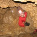
![]() by rickster » Apr 26, 2010 5:46 pm
by rickster » Apr 26, 2010 5:46 pm
- rickster
- Frequent Poster
- Posts: 81
- Joined: Apr 7, 2010 3:18 pm
- Location: Mcveytown , Pa
- Name: Rick OBanion
- NSS #: 62960
- Primary Grotto Affiliation: Cave Hill Grotto and Nittany Grotto Inc.
Re: help reading cave maps!!!
![]() by rlboyce » Apr 26, 2010 6:08 pm
by rlboyce » Apr 26, 2010 6:08 pm
Wow. Kind of surprised no one else has responded yet.
I'm not a map expert, so anything I tell you could be incorrect. With that in mind, I think the arrows indicate the gradient. I'm not sure which lines you are considering dashed, but they are probably where the passages are too narrow to traverse.
Cave maps can sometimes use different symbols, but usually the symbols are universal. When a non standard symbol is used, it's good practice to include a unique map key.
Here's a PDF of common map symbols I've found:
http://www.carto.net/neumann/caving/cave-symbols/uis_signatures_english.pdf
Hope that helps.
P.S. You might want to consider editing your post and taking down the link to that map. I don't know where you got it from, but you may hear some complaints from other board members about the map including a location...
Happiness can be measured in mud/in².
-

rlboyce - NSS Hall Of Fame Poster
- Posts: 727
- Joined: Jan 22, 2010 7:26 pm
- Location: Chambersburg, Pennsylvania
- Name: Ryan Boyce
Re: help reading cave maps!!!
![]() by Scott McCrea » Apr 26, 2010 6:18 pm
by Scott McCrea » Apr 26, 2010 6:18 pm
Those arrows are actually symbols that look like bird footprints. They show a slope in the floor. They 'point' up hill. So, in Kurtz Extension, the floor slopes down towards the lower wall.
Scott McCrea
SWAYGO
SWAYGO
-

Scott McCrea - Global Moderator
- Posts: 3198
- Joined: Sep 5, 2005 3:07 pm
- Location: Asheville, NC USA
- NSS #: 40839RL
- Primary Grotto Affiliation: Flittermouse Grotto
Re: help reading cave maps!!!
![]() by rlboyce » Apr 26, 2010 6:26 pm
by rlboyce » Apr 26, 2010 6:26 pm
Wow again. It's amazing what a person can do by a little alteration of an address. I was able to also find a picture of the cave entrance along with the names of nearby landmarks. I would have thought the PA Department of CONSERVATION and Natural Resources would be a little more careful about this kind of thing. Guess not...
Wonder what other caves I can find on the internet?
Wonder what other caves I can find on the internet?
Happiness can be measured in mud/in².
-
rlboyce - NSS Hall Of Fame Poster
- Posts: 727
- Joined: Jan 22, 2010 7:26 pm
- Location: Chambersburg, Pennsylvania
- Name: Ryan Boyce
Re: help reading cave maps!!!
![]() by MUD » Apr 26, 2010 6:43 pm
by MUD » Apr 26, 2010 6:43 pm
Hey Rick! 
Next time we get together I'll give ya all the info you can digest on cave maps. As a matter of fact, you can help us with some mapping projects if you'd like!
Next time we get together I'll give ya all the info you can digest on cave maps. As a matter of fact, you can help us with some mapping projects if you'd like!
- MUD
- NSS Hall Of Fame Poster
- Posts: 1242
- Joined: Mar 15, 2006 11:28 pm
- Primary Grotto Affiliation: None
Re: help reading cave maps!!!
![]() by wyandottecaver » Apr 26, 2010 6:48 pm
by wyandottecaver » Apr 26, 2010 6:48 pm
a moderator probably should kill the link, but given that it is in a major state publication and the name of the cave is "field trip cave" and its apparently right off the road from the pic, I doubt much more harm will ensue from it being available here. Heck, somebody might even learn something :)
I'm not scared of the dark, it's the things IN the dark that make me nervous. :)
-

wyandottecaver - NSS Hall Of Fame Poster
- Posts: 2902
- Joined: Aug 24, 2007 8:44 pm
- Location: Indiana
Re: help reading cave maps!!!
![]() by MUD » Apr 26, 2010 8:57 pm
by MUD » Apr 26, 2010 8:57 pm
wyandottecaver wrote:a moderator probably should kill the link, but given that it is in a major state publication and the name of the cave is "field trip cave" and its apparently right off the road from the pic, I doubt much more harm will ensue from it being available here. Heck, somebody might even learn something :)
The real problem here is people publishing this kind of thing without landowner permission! In this instance the state of PA. owns the cave since its right on the berm of a state highway. Which means the cave is closed, as are all PA. state owned caves because of the fungus amongus. I'd be willing to bet the state was never notified that there would be a map published of its location. Twice.
 As I've said before....some people just have to see their name in print.
What should be learned here is to NOT publish anything without landowner consent!
- MUD
- NSS Hall Of Fame Poster
- Posts: 1242
- Joined: Mar 15, 2006 11:28 pm
- Primary Grotto Affiliation: None
Re: help reading cave maps!!!
![]() by wyandottecaver » Apr 26, 2010 9:06 pm
by wyandottecaver » Apr 26, 2010 9:06 pm
well, they may not have known about the mapping at the time. But it was the State of PA in partnership with the USGS that published the map and entrance photo themselves. It may be a case of one hand not knowing what the other was doing, but in this case the "owner" published the information themselves.
granted, owner permission before any publication is important. We had an unfortunate incident with the 2007 NSS guidebook.....
granted, owner permission before any publication is important. We had an unfortunate incident with the 2007 NSS guidebook.....
I'm not scared of the dark, it's the things IN the dark that make me nervous. :)
-
wyandottecaver - NSS Hall Of Fame Poster
- Posts: 2902
- Joined: Aug 24, 2007 8:44 pm
- Location: Indiana
Re: help reading cave maps!!!
![]() by MUD » Apr 26, 2010 9:18 pm
by MUD » Apr 26, 2010 9:18 pm
Your right Todd! Shame on them then.
I really do hope that anyone reading this thread will take heed to the advice of ALWAYS getting landowner permission before publication!
I really do hope that anyone reading this thread will take heed to the advice of ALWAYS getting landowner permission before publication!
- MUD
- NSS Hall Of Fame Poster
- Posts: 1242
- Joined: Mar 15, 2006 11:28 pm
- Primary Grotto Affiliation: None
Re: help reading cave maps!!!
![]() by rickster » Apr 27, 2010 3:13 pm
by rickster » Apr 27, 2010 3:13 pm
Cavemud wrote:Hey Rick!
Next time we get together I'll give ya all the info you can digest on cave maps. As a matter of fact, you can help us with some mapping projects if you'd like!
Ok,!..lol i think.. ( not sure whaT THAT job entails.. does that mean I carry the water bucket?)

- rickster
- Frequent Poster
- Posts: 81
- Joined: Apr 7, 2010 3:18 pm
- Location: Mcveytown , Pa
- Name: Rick OBanion
- NSS #: 62960
- Primary Grotto Affiliation: Cave Hill Grotto and Nittany Grotto Inc.
Re: help reading cave maps!!!
![]() by JR-Orion » Apr 28, 2010 3:24 pm
by JR-Orion » Apr 28, 2010 3:24 pm
Here's a fun read on what it's like to help make a cave map-
http://www.nps.gov/archive/wica/Explori ... d_Cave.htm
http://www.nps.gov/archive/wica/Explori ... d_Cave.htm
Letting the days go by / water flowing underground
Into the blue again / in the silent water
Under the rocks and stones / there is water underground.
Into the blue again / in the silent water
Under the rocks and stones / there is water underground.
-
JR-Orion - NSS Hall Of Fame Poster
- Posts: 482
- Joined: Aug 28, 2009 12:21 pm
- Location: Illinois
- Name: Jasen Rogers
- NSS #: 61613
- Primary Grotto Affiliation: Iowa Grotto
Re: help reading cave maps!!!
![]() by Bob Thrun » Apr 29, 2010 1:12 am
by Bob Thrun » Apr 29, 2010 1:12 am
Be aware that the UIS Cave Map Symbola are not quite the same as the NSS Cave Map Symbols. They are closer together than they were 35 years ago. The two organizations took some symbols from each other in the process of revision. Unfortunately, I do not know of any place on the net where the NSS symbols are posted. The NSS does not have any small book on how to survey. Other organizations, such as the Association for Mexican Cave Studies and Missouri Speleological Survey have their own symbol sets that are close to the NSS symbols.
- Bob Thrun
- NSS Hall Of Fame Poster
- Posts: 322
- Joined: Jul 18, 2006 12:50 pm
Re: help reading cave maps!!!
![]() by Martin Sluka » Apr 29, 2010 3:43 am
by Martin Sluka » Apr 29, 2010 3:43 am
The list of different symbol sets therion may use (not user defined) - something as library of different symbol sets - read it from most right column:rickster wrote:new to caving , trying to decipher this map and was wOn this map , what do the arrows mean? , how about the dashed lines, i can see the pit clearly marked and I figured out the ceiling heights..?
http://www.dcnr.state.pa.us/topogeo/tbr ... gure38.pdf
Therion_symbols_(20100429).png
.png)
Martin
-

Martin Sluka - NSS Hall Of Fame Poster
- Posts: 402
- Joined: Mar 17, 2006 11:28 am
- Location: Prague, Czech Republic
- Name: Martin Sluka
- NSS #: 29010
Re: help reading cave maps!!!
![]() by Spike » Apr 29, 2010 9:54 am
by Spike » Apr 29, 2010 9:54 am
It looks like the map linked to uses the MSS symbol set. In particulare the small stalagmites and stalagtites are filled in triangles rather than the "Y"s used in the NSS and UIS symbol sets.
Here is a few pages out of the Art of Cave Mapping an MSS publication. It shows both MSS and NSS symbols. Also "British" symbols are depicted, even though I've seen some younger maps made by Brits that are a bit different than these.
http://www.incavedigitalsurvey.com/illu ... ymbols.pdf
Here is a few pages out of the Art of Cave Mapping an MSS publication. It shows both MSS and NSS symbols. Also "British" symbols are depicted, even though I've seen some younger maps made by Brits that are a bit different than these.
http://www.incavedigitalsurvey.com/illu ... ymbols.pdf
-

Spike - Prolific Poster
- Posts: 134
- Joined: Dec 23, 2005 3:25 pm
- Location: Central MO
Re: help reading cave maps!!!
![]() by hewhocaves » May 3, 2010 4:34 pm
by hewhocaves » May 3, 2010 4:34 pm
Cavemud wrote:The real problem here is people publishing this kind of thing without landowner permission! In this instance the state of PA. owns the cave since its right on the berm of a state highway. Which means the cave is closed, as are all PA. state owned caves because of the fungus amongus. I'd be willing to bet the state was never notified that there would be a map published of its location. Twice.
What should be learned here is to NOT publish anything without landowner consent!
You mean like the State of PA publishing the map of Tytoona Cave (an NSS preserve) on the same page? Hey, did they get our permission? As for the PA DCNR's wonderful conservation ethic - I've already gotten yelled at on other forums for my opinion of that. I suppose it's just good for them that the caving community doesn't follow their lead in conservation and caver relations.
As for the origin of the print map, both look like they come from karst guidebook authored by Will White, one of the most respected names in speleology. The guidebook, btw, is oft-cited in the literature and well written (as are all Will's things). Of course, once disseminated, the author has very little control over what happens to it.
The cave, btw, is a fun, if very short (20 mins) trip. I believe it was opened in the late 80s by blasting to widen the highway.
John
The NSS and WNS: Cooperation, not confrontation.
-
hewhocaves - NSS Hall Of Fame Poster
- Posts: 716
- Joined: Sep 5, 2005 9:43 pm
- Location: Morgantown WV
- Name: John Tudek
- NSS #: 36021
- Primary Grotto Affiliation: MonGrotto
15 posts
• Page 1 of 1
Return to Survey and Cartography Forum
Who is online
Users browsing this forum: No registered users
POWERED_BY
 Cavechat RSS Feed
 Cavechat is the official caving forum of the National Speleological Society.
The NSS is not responsible for the opinions expressed, and cannot verify the accuracy of information presented.
Cavechat is the official caving forum of the National Speleological Society.
The NSS is not responsible for the opinions expressed, and cannot verify the accuracy of information presented.