I thought I would start this thread 1) because my other thread on"Overlaying a Compass lineplot to ArcGIS Explorer" was getting
 and 2) the subject allows others who have questions about GIS software to post on here as well with out getting too far ...
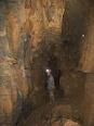
Anyway, I've been able to make a KML/KMZ overlay of surveyed caves on basemaps in arcgis Editor but I have another task that I'm trying to figure out that requires a little more expertise than I have (considering I'm a beginner) so hopefully you guys can help me out with this...
Question: How can I take a 3D model (as in Cave Viewer or CaveXO(CaveX if your using anything besides vista))from a COMPASS software program and place the cave under the basemap (like in the real world)in arcgis editor and line the elevations of the cave up so I can tell how far under surface (base map) I am in any point throughout the cave?
The base map would be in 3D (display elevation)...I would think that my question would be possible to resolve if I can just find a way.... I mean really if you think about it, you have the elevations of the cave, the elevations of the base map (if a topo is available), and the shapefile, what else is there? I really believe that ArcGIS Editor could be made A LOT simpler...