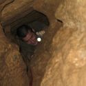
I wanted to post about a project I have been working on for several years that may be of interest to folks on this forum. It is a handheld, all-in-one, cave survey and 3D LIDAR mapping system called the Caveatron. I tried to design it to be as caver-friendly as possible with its operation based as much as possible on normal cave survey techniques and traditional survey stations. It not only takes distance, azimuth, and inclination measurements between stations in one shot, but also performs 3D scans to several centimeters of resolution. Scanning is accomplished by one of two methods – either by crawling, walking, or otherwise traversing towards a station (a “Passage” scan) or by holding it in place (either with a steady hand or on a rock) and rotating it in place (a “Room” scan). It has interchangeable LIDAR modules to accommodate different ranges, resolutions, and scan speeds. The Caveatron uses a touchscreen interface so station names are entered when taking shots and both line plots and LIDAR scan data can be viewed onboard while in the cave. It requires no extra equipment in the cave other than a thin plastic retroreflective card that is held on station while taking measurements.
My focus has been on trying to keep the Caveatron as integrated, easy to use, and most importantly, as low-cost as possible. Since I think the caving community would benefit from this technology, I have recently open-sourced the design so that anyone can build one. The Caveatron has proved resilient and versatile as I have used it to scan in about 20 caves so far with a wide range of conditions from mud and water passages, to belly crawls and narrow vertical fissures, to very large rooms, traversing boulder-strewn slopes, and in pits while on rope. Taking shots just takes a few seconds and the speed of the scanning process is just limited by how fast you move through an area and how much detail you want to get. The scan data can be post processed and displayed on a PC fairly quickly after downloading and usually comes together with minimal effort using a combination of post-processing software I wrote and several open source point cloud and meshing applications and I have 3D printed most of caves from the data.
Yes, the Caveatron is not as fancy or super high resolution as commercial systems and is not intended to compete against them since they will always produce superior results. But having seen the commercial systems and participated in surveys using them, I feel they are ultimately limited in what caves they can be practically used, take a lot of time, and are out of reach for most cavers. My goal with the Caveatron was a mapping system that can go just about anywhere underground, is quick to use, and has what I’d like to think is a practical and affordable design for cavers, and ultimately allow far more cavers to map caves in 3D than would otherwise be possible.
If you want to find out more about it, or might be interested in building your own, here are some links.
Caveatron webpage with pictures, scan examples, and general information about the design: http://caveatron.com
Github repository with mechanical drawings, wiring diagrams, bill of materials, and source code: https://github.com/Caveatron
Discussion forum on Google Groups: https://groups.google.com/forum/#!forum/caveatron-discuss
If you have any questions, send me an email or post it and I will try to answer!
Since I’ve never posted on CaveChat before, I figure I should give a short introduction – I’ve been an active caver in Texas for nearly 20 years and NSS member almost as long. I have been surveying for about 15 years, have run a few projects, been an officer in both my grotto and statewide caving organizations, and am currently on the board of the Texas Speleological Survey.
Joe Mitchell
Cavechat.org
The Official Caving Forum of the National Speleological Society
NSS Home Page |
Flickr NSS Photo Pool | Online Cavers Network
CaveChat Room |
NSS Bookstore | Find Local Caving Club
The Caveatron - A Cave Surveying and 3D Scanning System
Moderator: Moderators
7 posts
• Page 1 of 1
The Caveatron - A Cave Surveying and 3D Scanning System
![]() by JoeM » Sep 17, 2018 9:14 pm
by JoeM » Sep 17, 2018 9:14 pm
- JoeM
- Infrequent Poster
- Posts: 3
- Joined: Aug 18, 2018 11:08 pm
- NSS #: 49849
- Primary Grotto Affiliation: Bexar
Re: The Caveatron - A Cave Surveying and 3D Scanning System
![]() by CaverScott » Sep 18, 2018 7:14 am
by CaverScott » Sep 18, 2018 7:14 am
Welcome to CaveChat! 
And that is great first message!
And that is great first message!
-

CaverScott - NSS Hall Of Fame Poster
- Posts: 1132
- Joined: Sep 6, 2005 7:38 am
- Location: Birmingham, Alabama (TAG!)
- NSS #: 19797L
- Primary Grotto Affiliation: Birmingham CIG SCCi IKC
Re: The Caveatron - A Cave Surveying and 3D Scanning System
![]() by batrotter » Sep 19, 2018 7:27 am
by batrotter » Sep 19, 2018 7:27 am
Very interesting!
Awesome work!
Awesome work!
- batrotter
- NSS Hall Of Fame Poster
- Posts: 530
- Joined: Sep 6, 2005 9:20 am
- Location: Columbus, Indiana
- Name: Bruce Trotter
- NSS #: 27849RL
- Primary Grotto Affiliation: Indiana Cave Survey
Re: The Caveatron - A Cave Surveying and 3D Scanning System
![]() by PeterFJohnson » Sep 19, 2018 1:20 pm
by PeterFJohnson » Sep 19, 2018 1:20 pm
Interesting. Do you have a rough cost of the components to build one?
-
PeterFJohnson - Prolific Poster
- Posts: 110
- Joined: Nov 12, 2010 6:29 pm
- Primary Grotto Affiliation: Colorado Grotto + GVKS
Re: The Caveatron - A Cave Surveying and 3D Scanning System
![]() by JoeM » Sep 20, 2018 8:13 pm
by JoeM » Sep 20, 2018 8:13 pm
I estimate the cost of building one to be $500-$600 depending on which parts you use and where you can source them. It will be more if you can still find a SWEEP LIDAR (they are mostly no longer available). Right now the Caveatron only supports the SWEEP and Neato XV LIDARs, but I am close to having 12m RPLIDAR working, and it is not much more expensive than you can find an XV.
- JoeM
- Infrequent Poster
- Posts: 3
- Joined: Aug 18, 2018 11:08 pm
- NSS #: 49849
- Primary Grotto Affiliation: Bexar
Re: The Caveatron - A Cave Surveying and 3D Scanning System
![]() by trogman » Sep 26, 2018 4:08 pm
by trogman » Sep 26, 2018 4:08 pm
Nice! I like the fly-through 3D models.
Looking at the unit pictured on your website- it doesn't exactly look like it is built to handle cave environments. How waterproof/mudproof is it? We have some tough caves here in TAG!
Trogman
Looking at the unit pictured on your website- it doesn't exactly look like it is built to handle cave environments. How waterproof/mudproof is it? We have some tough caves here in TAG!
Trogman
-

trogman - NSS Hall Of Fame Poster
- Posts: 1017
- Joined: May 2, 2008 8:35 am
- Location: North Alabama
- Name: Stephen Brewer
- Primary Grotto Affiliation: Gadsden Grotto
Re: The Caveatron - A Cave Surveying and 3D Scanning System
![]() by JoeM » Oct 4, 2018 8:54 pm
by JoeM » Oct 4, 2018 8:54 pm
I'm sure you could find a cave to break it in! Nonetheless, I've tried to do what I can including O-ring seals around all openings in the enclosure or silicone around the windows, the windows and screen are all recessed to reduce the chance of scratches if dropped or banged into something and the screen has an extra protector layer. The screen still works ok even smeared with mud. Of course if mud gets on the laser or LIDAR windows it blocks the measurement, so some effort has to be made to keep them reasonably clean. Dust on the windows doesn't seem to hurt though. I have not tried dunking it yet - haven't wanted to take the risk! So, I put it in its case when I have to take it through water. So far, I have has nothing get inside it or affect any part of it that I couldn't wipe off.
I'm happy to hear any suggestions folks have for further ruggedizing it! Eventually, I want to develop a custom enclosure that you can 3D print which would make assembly much easier, make it smaller and hopefully incorporate additional ways to make it even more cave-resistant.
I'm happy to hear any suggestions folks have for further ruggedizing it! Eventually, I want to develop a custom enclosure that you can 3D print which would make assembly much easier, make it smaller and hopefully incorporate additional ways to make it even more cave-resistant.
- JoeM
- Infrequent Poster
- Posts: 3
- Joined: Aug 18, 2018 11:08 pm
- NSS #: 49849
- Primary Grotto Affiliation: Bexar
7 posts
• Page 1 of 1
Return to Survey and Cartography Forum
Who is online
Users browsing this forum: No registered users
POWERED_BY
 Cavechat RSS Feed
 Cavechat is the official caving forum of the National Speleological Society.
The NSS is not responsible for the opinions expressed, and cannot verify the accuracy of information presented.
Cavechat is the official caving forum of the National Speleological Society.
The NSS is not responsible for the opinions expressed, and cannot verify the accuracy of information presented.