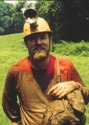
anyone to come play with me, I went ridge walking and caving...ALONE!
My goal today was to gather accurate GPS locations on a half-dozen or so
old caves in and around Vanlahr's Valley. These caves are intimately
associated with Webster Cave, whether they know it or not. Specifically,
I wanted to visit Melody Hill and the Briar Hole caves, as these
are/will be very significant to the survey in the time to come.
I made it to the area around 0930CST and immediately took the Jeep down
the farm access road to Melody Hill Cave. It had been nearly two
decades since I'd been here, and it wasn't at all what I'd remembered.
I walked over to a tree lined sink that should have been the cave; it
was. I took a few images, got the GPS, and then headed over towards
Briar Hole Sink and Vanlahr's Cave.
Way back in the mid-eighties, we did a little bit of work in Briar Hole
Cave. Todd Hack and I discovered it, and did the initial exploration.
Bill Holmes had also located a cave nearby, which was called Vanlahr's
Cave. Bill had never known of Briar Hole. My description of Briar Hole
and Vanlahr's from 1985 is as follows:

QUOTE
"This pair of caves, due to their proximity, are generally regarded as
one (although to date a connection
remains elusive). A hydrological connection is nearly assured. The two
entrances are located less than 40 feet
apart at the end of an 800 foot trench. Vanlahr’s Cave is
located in the south wall of the trench, below an exposed wall of
limestone. It may have to be dug into as well.
Briar Hole Sink is one of the more fascinating caves of the Complex, as
it is suspected to be directly
associated with Marathon Crawl of the Webster System. The cave floods
completely and should not be entered if
there is threat of rain. It begins as a low, wide, chert-filled crawl.
After several tight spots, a small room is
encountered. Here, in the floor, a tight rift leads down into an even
tighter, sinuous canyon. This canyon weaves
its way down over old rimstone dams, dropping about 15 feet in the
process. Eventually, it intersects a miserably
low water crawl.
What lies beyond here could be described as the worst section of cave in
the whole Complex. Starting off
with comfortable dimensions of three feet wide and two feet high, this
soon degenerates. After only a few dozen
feet, the passage lowers to around one foot. Worse still, the airspace
drops to about five inches. In places, it is
less. This continues for a hundred feet or more (the cave has yet to be
surveyed).
Eventually, the crawl breaks up into multiple passages, and intersects a
large trunk passage. To the left,
upstream, the passage is incompletely explored. At one point, an unusual
upward-trending side lead is found
which inputs a healthy amount of water into the cave. This water is
thought to originate from Vanlahr’s Cave.
Beyond this point the cave remains unexplored, but may connect with
Vanlahr’s.
Downstream of the junction, the passage enlarges, measuring three to six
feet high and 15 feet wide. A
shallow stream covers the floor. The sediments here are composed of
fragments of angular chert, identical to those
found in Marathon Crawl in the Webster System. The same sediments can
also be seen throughout Webster
Avenue near Marathon. This passage is thought to lead directly into
Marathon Crawl, although a physical
connection has yet to be made.
At a point approximately 400 feet from the junction, a sump is
encountered. This may be the back side of
the terminal sump found at the end of Marathon Crawl. There is at least
one side lead near here that may be dug
open and connected to similar leads found in Marathon. A survey would
help to confirm a possible connection..."
END QUOTE
Today, I made my way down to Briar Hole and started pulling out logs,
sticks, flood debris, and rocks. In short order I had the cave reopened,
and cold air was rising out. This cave is now ready to be surveyed!
After this, I trotted over to Vanlahr's Cave. Vanlahr's is only about
40 or 50 feet to the south, in the same trench complex. After pulling
away some flood debris, I stuck my head into a low wide cave passage. I
was shocked and excited to hear the sound of falling water off in the
distance. I donned my cave helmet and crawled in to take a look. I was
immediately met with a large chamber complete with bats. Around a few
corners and I was presented with the source of the sound: a nice
waterfall. The water was crashing out of a small lead and disappearing
into a low wide chert crawl. I am convinced this is the same water that
feeds Marathon. Hopefully, this cave will connect with Brair and at
least bypass the nasty water crawl just below its entrance.
I propose we concentrate our efforts on Marathon Crawl and these two
other caves, once we finish Giger and Upper Giger. There's a lot of
footage to be had, and perhaps a new entrance. Looks like we're about
1500 feet away from Marathon, but the lead trends towards these two
caves. The similarity between the caves and Marathon is significant.
Although it (Briar Hole) appeared to end in a sump, there were lots of
side leads, so maybe we can make the connection this summer. I left
some flagging tape near the two entrances to assist others in finding
them. If we could get two survey teams going on one day, we could knock
out a significant portion of both.
Leaving Briar behind, I walked south, up Dempster Ridge, to Turtle Sink.
This is another cave discovered back in the 80's. This deep sink is
located high up the ridge slope. It's pretty deep, probably 35 feet or
more, and has a rock lined passage at the bottom. It was blowing some
air and with a little bit of digging looks like one could open up a
small canyon passage. It's some distance from Upper Giger, but needs to
be looked at too.
Leaving Vanlahr's Valley, I walked over to Basham Sink. This rock
filled sink is located right under HWY333, and has a sizable cave
beneath. I was unable to see the way down through the boulders. It is
possible they may have shifted to the extent that entry is impossible.
I could feel cool air blowing out though. I think I saw the way in, but
with out gear I decided against it. This cave is close to both Bundy
Canyon and Necronom leads.
After picking a bunch of ticks off my clothes, I headed over to Mr. and
Mrs. Shilts place for conversation. Charles Vanlahr soon joined us, and
I showed off the latest set of maps for the cave survey. Overall, it was
a good day, and I am happy that we have two good caves now to survey. I
took some images, and even shot a short video of the days exploits. You
can visit them at...
Ridge walking video: http://www.youtube.com/watch?v=UouYIN3XbHI (note:
17MEG file)
Ridge walking images:
http://www.pbase.com/darklightimagery/b ... lahrs_cave
I'm trying something new with the video site. On my computer, the sound
isn't sync'd with the video. Maybe you all will have better luck...
-- Chris and Teresa Anderson http://www.darklightimagery.net http://www.pbase.com/darklightimagery http://groups.yahoo.com/group/WCCSG/