The first trip was led by John Lyles and included Shawn Thomas, Abby Tobin, and myself. We entered the cave on July 7 and traveled through the historic trunk section until we reached Mud Turtle Landing, where the Snowy River passage branches off to the north and south.

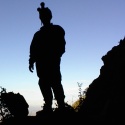
John, Shawn, Abby and Derek at the entrance.
We continued south carrying heavy packs loaded with 5 liters of water, food for 24-30 hours, clean and dirty clothes and footwear, survey gear, and several rolls of thick poly tarps used to cross mud banks (aka "magic carpets"). To travel on Snowy River we changed into clean clothes and wore white-soled shoes, in order to avoid marking the calcite floor. However, to get to the end of the survey it is necessary to cross a few breakdown collapse areas and mud banks that require either a change to dirty shoes and gloves, or a full change back into dirty clothing.

Shawn, Abby and John and a clean/dirty transition area.
We traveled through the Crawl from Hell (~1,000' of mostly hands and knees), through the muddy belly crawl in Mud Lizard passage, along the seemingly endless walking passage of the Underground Railroad, and back through the more than 3 miles of new passage surveyed in the past year. We began surveying in the lead that was left in April, which was 20' wide by 50' high.

John sets point at the beginning of our survey while Abby and Derek prepare to collect data.
Within a short distance the Snow River formation dove under a low ceiling ledge and we had to transition into dirty shoes to cross above.

Abby records inventory in the upper level bypass.
We climbed back down to Snowy River briefly before another large breakdown area forced us to climb over. We had to repeat this a couple times before we came upon a large pool that we called "Finger Lake". This is the largest pool yet discovered in Snowy River South, and may help support day or camp trips in the future.

Snowy River Passage

Abby holds a light on station at the edge of Finger Lake.
Shortly after passing this lake the passage became blocked by a huge breakdown collapse from an upper level canyon. We were forced to climb up and survey over the top of the breakdown. The route-finding became much more difficult and the sketching was considerable slower with added complexity.

Derek sketches in the breakdown section called "Rough Country".
We encountered the Snowy River formation a couple more times, but in each case it traveled ~100' and then disappeared back into breakdown.

Shawn comments on the prospect of following Snowy River.
We ended the survey after midnight in a large breakdown passage, where the continuation was not obvious. We spent a little while scouting around until determining that the passage continued up and over a large hill.

John sets point in a tall breakdown passage/fissure near the end of the survey.
We headed for the entrance around 1 am and spent some time laying out magic carpets to make future travel to the edge of the cave more efficient. Several of us got quite sleepy on the trip out, to the point where we were "walking impaired". We took a 15 min nap that revived us enough to make it the rest of the way out. We emerged to a sunny morning at 9 am after 25.5 hours. We surveyed a little over 1,700'. The trip to the end of the survey and back is now over 16 miles (26 kilometers).

Near the end of the survey we retreated to Snowy River to enjoy a brief break.
I want to acknowledge the many Fort Stanton Cave Study Project (FSCSP) members who have contributed countless hours to the project over the years. The explorers who discovered Snowy River through digging, the surveyors that pushed the cave to its current known extent, the workers who dug the SR access shaft and built the shaft structure, and the project directors that organize the expeditions and arrange the permits have all done much more work to make this trip possible than any of us who were fortunate enough to have the opportunity to survey the boundary. This is a very large team effort.
Derek Bristol