March TestingDUSII still had no firmware update, so no testing, but I did hear from Sean that he had sent off the design for the new DUSI boards. So maybe by next time, I will have the newest DUSI to test.
Disto XWe ran the Disto X through the test course with the calibration from February, the average error was 0.34 azimuth and 0.15 elevation. It had been 0.21 and 0.13 when the calibration was fresh back in February. Then ran the survey loop. All FS/BS matched within a degree and we did not have to repeat any shots. Loop closure was 0.5 ft horizontal and 0.5 ft vertical. Data seemed good, but as previous times we do see an increase in the average errors as the calibration gets older.
Side Topic:
During the loop survey I took a bunch of splay shots at every station with the Disto X. Downloaded these and pasted into Walls. Looks pretty neat with the passage turned on in the Display Map mode.

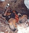
Exported to SVG and opened in Illustrator. It is interesting to see all this wall detail. Put into the UMPC (running Window XP Tablet) and thought it would be neat to try to sketch on the UMPC in the cave. But I'm neither an Illustrator expert or a good sketcher, but I got lucky and found a volunteer who was willing to give it a try. Pat spent about a hour in the cave with the UMPC drawing a map.

She said it was difficult to figure out how to get started since it is so different than a normal survey. She said she had to remind herself it was just Illustrator 10, same as she normally uses to draw cave maps. Drawing with a stylus on a screen is a bit different than normal. She thinks it has potential, and the UMPC with its 7 inch screen is an acceptable compromise in all but very big passage (it is 9.5" x 5.5" inside the Otterbox, with the longlife battery). I remember Aaron's comment from using a much bigger Tablet PC in a cave that the best thing was never having to change pages!After the Disto X test, we didn't recalibrate, instead we sent the Disto X on a real survey to the tight canyons above Cow Falls. The original survey was full of "faked" shots because it was impossible to get into position to read a compass. And it was all older surveys (some was Brunton, not Suuntos). Tom, Lee-Gray and Dan tackled the resurvey. Lee-Gray read the Disto X (he says he is "in love") and Tom complained about the difficulty in actually getting into position to write in the book in the awkward canyon. It was Dan's first trip and he was faced with trying to set points in an impossibly tight canyon with no survey experience. Still Tom claimed they were about twice as fast as a normal survey party. They did have to repeat some shots but said it was quite easy to do.
The next day, Dave Carson ran Disto X through the survey loop again, while we were running the Ponies on the test course. Unlike 2 days before we had some FS/BS agreement trouble, 6 shots with more than 1 degree difference, worst was 1.5 degrees. Several shots were repeated. Interestingly the loop closed better than 2 days before with no FS/BS issues The horizontal closure error was 0.1 ft and vertical was 0.2 ft. I'm guessing that these closure errors are in the noise.
I then recalibrated the Disto X, ran the test course and ran the survey loop. The delta for the calibration was 0.19 degrees - slightly better than the 0.20 I had gotten on all the recent calibrations. Like in February I used the Disto X calibration routine that Luc (the Auriga guy) wrote for the Palm. I prefer the Palm Tungsten E2 with his calibration software to the Dell Axim /Windows Mobile / Pocket Topo version. I really like the "Clear Disto X Memory" feature in Luc's software. But when I downloaded Disto X data I did use Pocket Topo, which runs fine on the laptop or UMPC with Window XP, so a Windows Mobile machine is not necessary to run the software. Pocket Topo can export a text file which can be pasted into Walls or into Excel.
The Disto X test course result was 0.23 az and 0.13 elev average errors. This was pretty typical of fresh calibrations on the Disto X. Ran the Disto X through the survey loop in record time (didn't write down the data, downloaded in the car on the way home). All FS/BS agreed, and no shots needed to be repeated. Closure error was 0.7 ft horizontal and 0.1 ft vertical.
I'm generally please with the Disto X. I don't have any problems trusting it on a real survey. I'm not sure I would want to go much longer than a month between calibrations, but it is easily to calibrate.
PonyI have been unhappy with the Pony calibrations since we had to set up a new calibration course. We learned in January that it was not a problem with my Pony (Aaron's gave similar results) and if I used all the test course stations to calibrate the result was better than using half (like the Disto X). Still the results were not encouraging and they were not as good as the Great Onyx calibration results.
In February we set up an additional 8 stations at 2 different elevation angles (-17.5 degrees and +17.5 degrees) and at different azimuths than the other stations. We re-shot all these stations with the Theodolite to get the "truth" data needed for a Pony calibration (although Phil is working on software that does not require truth data).
Since I still had Aaron's Pony, I decided to calibration one Pony using all the stations, and the other using half the stations. So my Pony had 5 elevation angles with azimuth shots every 45 degrees, and Aaron's Pony had 5 elevation angles with shots every 90 degrees. These were staggered so the azimuths were not all the same. I discovered that the Pony has a 150 shot limit for calibration data (raw data) so I ended up overwriting the first 3 sets of level data on my Pony.
I was encouraged after running the calibration software, my Pony had an average Calibration error of 0.28 degrees with only one individual error over a degree and that was 1.05 degrees. Aaron's Pony with half the shots had an average calibration error of 0.48 and 4 shots of over 1 degree error, the worst was 2.11 degrees. This was a vast improvement over both sets of January data (0.81 for all stations and 1.66 for half the stations). Obviously adding those other elevation angles is critical.
We then ran the Ponies through the test course (these are the same stations used to calibrate, so this would represent the best you can expect). We got az/el average errors of 0.44 /0.20 for my Pony and 0.40 / 0.14 for Aaron's Pony. So Aaron's Pony with half the stations did better (but I was missing 3 of the level shots for mine).
Dave and Roger ran both Ponies through the Survey loop while I recalibrated the Disto X. No problem with FS/BS agreement on my Pony, but Aaron's had 3 shots with errors over 1 degree. None worse than 1.5 degrees however. My Pony's loop closed with 0.4 ft horizontal, 0.3 ft vertical, Aaron's had 0.2 ft horizontal and 2.9 ft vertical. One possible issue is that Aaron's Pony had a bigger laser spot than my Pony. In various experiments/mods I managed to fry the original laser in my Pony and had to replace it. My replacement has a better spot than the original, which elongates at larger distances.
I'm not sure what to make of this. My Pony had best calibration average errors and FS/BS agreement. Aaron's had best test course results, especially in elevation, but his elevation loop closure was off.
I need to modify my old Pony fixture, since using the "all purpose" fixture will have some affect on the Pony's accuracy. And I'd like to try adding at least one more elevation angle to see what the affects on the Pony calibration are. I think the Pony will be limited by the calibration approach Phil is using. I'd like to see Sean's DUSI calibration approach running on the Pony. It will have to have some changes made to the Pony firmware to handle a different calibration matrix, but it is possible, and both DUSI and Pony software is Open Source.
That's it for now. I have lots of plots and pages of spreadsheets that await further analysis. Summary Table below.