crediting surveyors (from "publications" forum)

Techniques, equipment and issues. Also visit the NSS Survey & Cartography Section.

Moderator: Moderators

crediting surveyors (from "publications" forum)

Postby Jeff Bartlett » Mar 12, 2008 8:09 pm

driggs wrote:
xcathodex wrote:
george dasher wrote:List of surveyors: Yes, you can list the surveyors by the number of trips. I usually do it as such: Bob Alderson (12 trips), Bob Anderson (11), Gordon Brace (10), George Dasher (1), etc.


Thank you sir! I vaguely recall there being an example in the back of On Station that followed this paradigm. The map I'm currently working on has had 90+ surveyors involved with the project, the highest total number of trips being 40, and I'm trying to find a reasonably fair way to list them all! I think that will work beautifully.


Therion can list contributors ranked by the total sum of survey length they contributed (rather than number of trips). See this example. For more info, see the statistics command under layout in the Therion Book (or just add `statistics explo-length on` to the layout block in your 'thconfig' file).


in regard to ranking/ordering the surveyors on a large project,

Bryan Signorelli and I are collaborating on the cartography here: Bryan is managing all the survey data and generating the SVGs from walls for round-tripping, while I am doing all the artwork in Illustrator. Bryan has some very extensive spreadsheets on surveyor participation, ordered alphabetically, by number of survey trips, and by survey footage.

However, we've been disinclined to use total footage as the factor for ordering the list. As is typical with large cave projects (we're at about 7.76 miles of data), early surveys accumulated enormous chunks of survey footage, often 1500' or more on a single survey. This cave was "discovered" in 1990, and many of these surveys were done to a rather poor standard compared to our modern work, including a lack of backsights and, in the earliest instances, sketchers not using a scale or protractor.

As such, many those who "tagged along" for 2 or 3 surveys in the beginning, when the discoveries were massive and the going was easy, can claim 3,000 or 4,000 feet of survey. Many just wanted to see the new cave everyone was talking about, and never came back. Fast forward to the latter part of this decade, where the project is experiencing a bit of a renaissance, and you find dedicated cavers who've surveyed 6 or 8 times and still haven't caught up to the old-timers in terms of survey length.

The newer surveys certainly aren't any easier - they're still typically 8 or 10 or 12 hour trips, often typified by crawling or wet passage since the nice easy stuff has all been done. The reasoning on my part is this: a caver who surveyed twice in 1990 for 10 hours each trip has devoted 20 man-hours to the survey of this cave. a caver who surveyed five times in 2004-2006 for 10 hours each trip has devoted 50 mna-hours to the survey of this cave... and this doesn't even account for the fact that the modern caver isn't getting to push huge virgin borehole passage, he or she is here because they either like to survey, want to see the map completed, or both.

How could I give the surveyor from 1990 top billing? Because he got to stroll through a pair of 1400' surveys with no backsights in walking passage on a 5-man team where he likely did very little? As such, I'm of the opinion that "number of trips" is the more accurate representation of each person's involvement in the project, and the time and effort they have invested.
"Although it pains me to say it, in this case Jeff is right. Plan accordingly." --Andy Armstrong
User avatar
Jeff Bartlett
NSS Hall Of Fame Poster
 
Posts: 948
Joined: Jun 29, 2007 12:19 am
Location: Chattanooga, TN
Name: Jeff Bartlett
NSS #: 59325
Primary Grotto Affiliation: Tennessee Cave Survey
  

Re: crediting surveyors (from "publications" forum)

Postby Scott McCrea » Mar 12, 2008 8:23 pm

Would it be possible to list them by the number of stations they set? Sometimes this is a better way to measure the production of a trip. Sometimes, 30 stations yields 1200'. Other times, 30 stations may not even get 300'.

Then again, there are those times when cavers can survey for 12 hours, get only 250' and set 8-10 stations. For instance, at Gap Cave, VA, Dan Henry had several trips to the VLR (Very Large Room) where he netted only a couple hundred feet and less than a dozen stations, but, they set dozens of splays and the cross sections took up whole pages at 50' to the inch.

Anyway, I would say it should be handled on a cave by cave basis. The nature of the cave may help determine how rank the participants.
Scott McCrea
SWAYGO
User avatar
Scott McCrea
Global Moderator
 
Posts: 3198
Joined: Sep 5, 2005 3:07 pm
Location: Asheville, NC USA
NSS #: 40839RL
Primary Grotto Affiliation: Flittermouse Grotto
  

Re: crediting surveyors (from "publications" forum)

Postby wyandottecaver » Mar 12, 2008 8:40 pm

I would think trip-hours the best indicator (when available) followed by # of trips. You could also divide credits into "principal surveyors" "cartographers" and "survey contributors" based on who deserved what based on their contributions.
I'm not scared of the dark, it's the things IN the dark that make me nervous. :)
User avatar
wyandottecaver
NSS Hall Of Fame Poster
 
Posts: 2902
Joined: Aug 24, 2007 8:44 pm
Location: Indiana
  

Re: crediting surveyors (from "publications" forum)

Postby cavedoc » Mar 12, 2008 11:13 pm

xcathodex wrote: As such, I'm of the opinion that "number of trips" is the more accurate representation of each person's involvement in the project, and the time and effort they have invested.


Agreed. All the maps I've done that listed something listed number of trips. Seems to be the most common choice that I've seen. I can think of one cave with decades of data that uses # of stations. It does tend to be a motivator to stay above whatever the threshold is to get your name on the map. I don't think I've seen a single map with footage listed.

Is this a regional thing? I'm out West.
Roger Mortimer
User avatar
cavedoc
NSS Hall Of Fame Poster
 
Posts: 455
Joined: Sep 5, 2005 3:30 pm
Location: Fresno, CA
Name: Roger Mortimer
NSS #: 26529
Primary Grotto Affiliation: San Joaquin Valley Grotto
  

Re: crediting surveyors (from "publications" forum)

Postby steelwool » Mar 13, 2008 1:41 am

I rank my surveys by the number of hours spend underground.
Cave with the best, cave alone!
User avatar
steelwool
Frequent Poster
 
Posts: 77
Joined: Sep 22, 2005 10:50 pm
Location: Planet Earth
Name: Philip Schuchardt
NSS #: 55634
Primary Grotto Affiliation: VPI Cave Club
  

Re: crediting surveyors (from "publications" forum)

Postby Dwight Livingston » Mar 13, 2008 7:33 am

To me, this weighing of contributions seems to be the wrong approach. I don't think the purpose of the list is to give credit. It is not like the movie credits.

To my mind, surveyors should be listed on a map as a reference, showing the source of the information presented in the map. It is like any reference in a formal paper, indicating where your data came from. For that purpose, it doesn't matter how many trips or hours each person contributed, nor how important or unimportant they were. And it doesn't include your mother and personal trainer, just those who surveyed and collected the data.

Yeah, I like to see my name on a map. But I don't think of it as credits.

Dwight
***************
Dwight Livingston
User avatar
Dwight Livingston
NSS Hall Of Fame Poster
 
Posts: 323
Joined: Sep 6, 2005 7:17 am
NSS #: 27411
Primary Grotto Affiliation: Baltimore Grotto
  

Re: crediting surveyors (from "publications" forum)

Postby tncaver » Mar 13, 2008 7:54 am

[quote="Dwight Livingston"]To me, this weighing of contributions seems to be the wrong approach. I don't think the purpose of the list is to give credit. It is not like the movie credits.
Yeah, I like to see my name on a map. But I don't think of it as credits.

Dwight,
The weighing of contributions to a cave map may not appeal to you but it does to a lot of mappers. It has been said
by some on this forum that it doesn't matter who finds a cave or who explores it, it is only the mappers who will
be remembered. That is just one example of how important some cavers think it is to have their names on a map.
I disagree with them though. I think the persons who discover and explore a cave are just as important as those who
map a cave. The mappers would not be mapping a cave is someone hadn't gone to the trouble to go out and look
for it. One way for the discoverer to get credit is to register caves on a state survey. True, more people will see the
map than will read the narrative description of the cave discovery, but that makes the narrative that much more rare
in a historical way. Many times only the cartographer's name appears on a map. That gives no credit to those who helped
make it happen.

Here in Tennessee, there are thousands of unmapped caves. One reason is that there are so many caves to be discovered
that only the biggest or best caves get mapped. I have one cave that I have been trying to get mapped for years with
no luck. It is about a mile long. Another one was Rumbling Falls Cave. I tried to get my friends to help explore it with
no luck. Then someone else came along and mapped it and kept all the details a secret from me.

I think it is important to credit everyone who helps map a cave and just as important to document who finds a cave and
explores it even if a map isn't drawn up. It is all historical data. :waving:
tncaver
NSS Hall Of Fame Poster
 
Posts: 2642
Joined: May 17, 2007 7:03 pm
  

Re: crediting surveyors (from "publications" forum)

Postby Ralph E. Powers » Mar 13, 2008 10:08 am

I've been on a number of cave survey trips but my name doesn't appear on a lot of the finished maps. In some cases the survey leader only wants to credit those who have been on more than one trip. Other cases the leader totally forgot that I was even there (what does that say? :doh: 
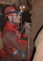
). Somehow they lost the notes that I was either tape or instruments or whatever my present duty was at the time.
Over time you learn that it's not that a big deal. YOU know that you were on the trip and you know that you surveyed this or that passage, as the time spent in said passage becomes intimate while waiting for the rest of the team to do whatever it is that they needed to do (sketch, compute azimuths, etc.).
But on the maps where my name does appear... it's a good feeling. :grin:
Without the possibility of death, adventure is not possible. ~ Reinhold Messner


http://ralph.rigidtech.com/albums.php
User avatar
Ralph E. Powers
NSS Hall Of Fame Poster
 
Posts: 2101
Joined: Sep 10, 2005 5:48 pm
Location: Chattanooga, TN
NSS #: 37616
  

Re: crediting surveyors (from "publications" forum)

Postby Jeff Bartlett » Mar 13, 2008 10:25 am

Dwight Livingston wrote:To me, this weighing of contributions seems to be the wrong approach. I don't think the purpose of the list is to give credit. It is not like the movie credits.


Well, I don't intend to leave anyone off the map. If you helped survey the cave, you deserve to have your name on there as far as I'm concerned. That said, I'm also not going to bill the 50 "one-timers" above the guy who'll be participating in his 41st survey next saturday.
"Although it pains me to say it, in this case Jeff is right. Plan accordingly." --Andy Armstrong
User avatar
Jeff Bartlett
NSS Hall Of Fame Poster
 
Posts: 948
Joined: Jun 29, 2007 12:19 am
Location: Chattanooga, TN
Name: Jeff Bartlett
NSS #: 59325
Primary Grotto Affiliation: Tennessee Cave Survey
  

Re: crediting surveyors (from "publications" forum)

Postby NZcaver » Mar 13, 2008 10:34 am

tncaver wrote:It has been said by some on this forum that it doesn't matter who finds a cave or who explores it, it is only the mappers who will be remembered.

Which begs the question - what caver, in good conscience in this day and age, would knowingly be the first to explore a cave without making some effort to survey and map it as they go? Or is this an ethic not present in all caving regions?

I think it's nice (and appropriate) to have my name listed on a map that I contributed to, but personally I'm not too fussed about whether it lists how many times I was in there surveying or how many feet I helped to add. But I can understand how those who toil away at one project year after year should maybe get a little extra recognition than those who are one-timers on the project.
User avatar
NZcaver
Global Moderator
 
Posts: 6367
Joined: Sep 7, 2005 2:05 am
Location: Anchorage, Alaska
Name: Jansen
NSS #: 50665RL
  

Re: crediting surveyors (from "publications" forum)

Postby George Dasher » Mar 13, 2008 10:35 am

I like to "weigh" the survey credits because I want to thank the people who have been on almost all the trips a "little more."

And speaking as someone who has only done one survey trip in XYZ Cave, I really don't want to be given the same credit as someone who went on all the trips--or on the harder trips.

I do the weighing by number of trips, rather than hours underground, footage surveyed, or stations mapped because I feel this is one of those subjects (like cave length) where you can very quickly become too anal about the subject.

And besides, a person can go on five or six really hard trips to a nasty part of the cave, and still get less footage or stations than someone who helped map a really easy trunk passage near the entrance.
User avatar
George Dasher
NSS Hall Of Fame Poster
 
Posts: 693
Joined: Sep 22, 2005 2:00 pm
Location: West Virginia
NSS #: 16643
Primary Grotto Affiliation: Charleston Grotto
  

Re: crediting surveyors (from "publications" forum)

Postby George Dasher » Mar 13, 2008 10:41 am

Also, I often explore the cave before surveying it.

That's because many (or most of) the caves are very short s**t holes where you have to decide if mapping it is really necessary.

Many people forget that fact, and think most caves are long.
User avatar
George Dasher
NSS Hall Of Fame Poster
 
Posts: 693
Joined: Sep 22, 2005 2:00 pm
Location: West Virginia
NSS #: 16643
Primary Grotto Affiliation: Charleston Grotto
  

Re: crediting surveyors (from "publications" forum)

Postby NZcaver » Mar 13, 2008 10:54 am

George Dasher wrote:Also, I often explore the cave before surveying it.

That's because many (or most of) the caves are very short s**t holes where you have to decide if mapping it is really necessary.

Many people forget that fact, and think most caves are long.

Ah yes, good point.

But if any are not just "short s**t holes" I would assume you'd plan to return and survey them, yes? Up this way, sometimes we even survey the really tiny holes because it's good practice and we can't afford to be too picky. :wink:
User avatar
NZcaver
Global Moderator
 
Posts: 6367
Joined: Sep 7, 2005 2:05 am
Location: Anchorage, Alaska
Name: Jansen
NSS #: 50665RL
  

Re: crediting surveyors (from "publications" forum)

Postby George Dasher » Mar 13, 2008 11:21 am

Sometimes I return...

Sometimes I just whine a lot...

Right now I have one with a bad climb in the back which I really don't want to do...
User avatar
George Dasher
NSS Hall Of Fame Poster
 
Posts: 693
Joined: Sep 22, 2005 2:00 pm
Location: West Virginia
NSS #: 16643
Primary Grotto Affiliation: Charleston Grotto
  

Re: crediting surveyors (from "publications" forum)

Postby tncaver » Mar 13, 2008 12:36 pm

George Dasher wrote:Also, I often explore the cave before surveying it.

That's because many (or most of) the caves are very short s**t holes where you have to decide if mapping it is really necessary.

Many people forget that fact, and think most caves are long.


That is so true here in Tennessee. Personally I've found over 200 caves but have only helped map 5. I am appreciative
that my name appeared on all five maps. As for the 200 plus caves that I have not mapped, 95% of them are in the
"s**t hole category. The other 5% are good caves. Of the 5 caves I helped map, only one of them is one of my personal
discoveries, although I may have contributed to their discovery. So most of my best discoveries
are not mapped and I have been unsuccessful getting my "caving buddies" interested in mapping them. In the past there
have been so many interesting caves to be discovered in Tennessee that finding people interested in dedicating themselves
to a particular cave to be mapped beginning to end has not been easy. However, with all the cave closures and land lost
to caver access it may become easier to find willing participants in the future "IF" access is still available. :tonguecheek:
tncaver
NSS Hall Of Fame Poster
 
Posts: 2642
Joined: May 17, 2007 7:03 pm
  

Next

Return to Survey and Cartography Forum

Who is online

Users browsing this forum: No registered users