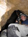
During Convention...
Who had the military "total station" instrument at the Mammoth Cave map area on Wed or Thurs?
The instrument "shot" distance and inclination, and had a compass attachment.
You couldn't get near the thing, as there were just too many people around it.
I think it was Aaron Addison, but I am not sure. It is not that I don't know Aaron, it is just that my memory of Convention has become just a sea of faces...
Cavechat.org
The Official Caving Forum of the National Speleological Society
NSS Home Page |
Flickr NSS Photo Pool | Online Cavers Network
CaveChat Room |
NSS Bookstore | Find Local Caving Club
"Total Station" instrument at Convention
Moderator: Moderators
6 posts
• Page 1 of 1
"Total Station" instrument at Convention
![]() by George Dasher » Aug 2, 2007 8:20 am
by George Dasher » Aug 2, 2007 8:20 am
-

George Dasher - NSS Hall Of Fame Poster
- Posts: 693
- Joined: Sep 22, 2005 2:00 pm
- Location: West Virginia
- NSS #: 16643
- Primary Grotto Affiliation: Charleston Grotto
Total Station
![]() by Eric Wright » Aug 2, 2007 9:55 am
by Eric Wright » Aug 2, 2007 9:55 am
George, I wasn't at the convention, but was this instrument smaller than a true total station? Small enough to take caving? I'd be interested in hearing more about it too. I'd especially like to know how data logging works with it (bluetooth, serial, etc). Sounds interesting.
-
Eric Wright - Infrequent Poster
- Posts: 14
- Joined: Jul 11, 2007 12:58 pm
- Location: Dillon, MT
![]() by Bob Thrun » Aug 4, 2007 11:17 am
by Bob Thrun » Aug 4, 2007 11:17 am
I did not see the instrument on display in the gym. Aaron Addison mentioned that Laser Technology Inc. just introduced a low-priced model, compared to earlier instruments by other companies. The company and its one press release can be found at http://www.lasertech.com The new model is the TruPulse 360. Good luck finding a price or even a picture. (There is a Flash presention that I did not view. I refuse to load Macromedia Flash. It makes bigger downloads with pictures that jump around.)
Older instruments are (were?) made by Laser Atlanta and MDL (Scotland). These were over $4000 a few years ago when I checked.
Older instruments are (were?) made by Laser Atlanta and MDL (Scotland). These were over $4000 a few years ago when I checked.
- Bob Thrun
- NSS Hall Of Fame Poster
- Posts: 322
- Joined: Jul 18, 2006 12:50 pm
![]() by Rick Brinkman » Aug 4, 2007 3:01 pm
by Rick Brinkman » Aug 4, 2007 3:01 pm
Here's a link to more info on the TruPulse 360 and a price.
http://rangefinder.jadaproductions.net/ ... dnumber=13
$1600 is still kinda pricey for caving, and it still won't speed up the sketch.
http://rangefinder.jadaproductions.net/ ... dnumber=13
$1600 is still kinda pricey for caving, and it still won't speed up the sketch.
Caves are rare and precious things. Cavers...even more so. Treat each accordingly.
NSS#42385(not current...give me a reason to change...(Sept 2010))
http://www.CoffeeCreekGear.com
NSS#42385(not current...give me a reason to change...(Sept 2010))
http://www.CoffeeCreekGear.com
-

Rick Brinkman - NSS Hall Of Fame Poster
- Posts: 376
- Joined: Sep 5, 2005 6:54 pm
- Location: Coffee Creek, MT
- Name: mt_vertcaver
- Primary Grotto Affiliation: Montana-Independent
Re: Total Station
![]() by lleblanc » Aug 10, 2007 2:28 pm
by lleblanc » Aug 10, 2007 2:28 pm
Eric Wright wrote:George, I wasn't at the convention, but was this instrument smaller than a true total station? Small enough to take caving? I'd be interested in hearing more about it too. I'd especially like to know how data logging works with it (bluetooth, serial, etc). Sounds interesting.
I contacted LaserTech soon after Aaro Addison's presentation; I already received the data protocol and plan to implement serial/Bluetooth support for the TruPulse 360 in Auriga (http://www.speleo.qc.ca/Auriga) as soon as I can get my hands on one. Given that the unit sends the distance, the heading and the inclination all at once, the software should be able to detect retries (common with rangefinders) as well as breaches in the input sequence (main shot + LRUD) that occur when a measurement is irrelevant because the survey station lies against the wall, making the whole process smarter than working with a simple Disto and regular compass and clino.
Luc Le Blanc
-

lleblanc - Frequent Poster
- Posts: 87
- Joined: Aug 10, 2007 2:19 pm
- Name: Luc Le Blanc
![]() by Marbry » Aug 11, 2007 1:36 pm
by Marbry » Aug 11, 2007 1:36 pm
It is a bit pricy for electronics to to drag into a cave, but certainly within reason now.
It would be awesome for solo surveying though.
Just need to incorporate a 6MP digital camera so you can automatically have a photo of each shot. ;-)
It would be awesome for solo surveying though.
Just need to incorporate a 6MP digital camera so you can automatically have a photo of each shot. ;-)
- Marbry
- Frequent Poster
- Posts: 51
- Joined: Dec 27, 2006 5:01 pm
- Location: Murfreesboro, TN
- NSS #: 27221
- Primary Grotto Affiliation: Nashville Grotto
6 posts
• Page 1 of 1
Return to Survey and Cartography Forum
Who is online
Users browsing this forum: No registered users
POWERED_BY
 Cavechat RSS Feed
 Cavechat is the official caving forum of the National Speleological Society.
The NSS is not responsible for the opinions expressed, and cannot verify the accuracy of information presented.
Cavechat is the official caving forum of the National Speleological Society.
The NSS is not responsible for the opinions expressed, and cannot verify the accuracy of information presented.