red stars are frac wells
violet triangles are violations reported
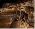
green and blue dots are PA caves
Frac data provided by http://data.fractracker.org/
For some background on the fracing topic read http://www.orionmagazine.org/index.php/articles/article/5839/ and http://www.csmonitor.com/Environment/2010/0909/EPA-to-natural-gas-companies-Give-details-on-fracking-chemicals
I have compiled a list of violations that took place near PA caves. Feel free to email peter@well.com if you need use of the full database. The violations base is available from me in kml form, or from http://data.fractracker.org/ in csv. The data includes ref numbers that can be used for further investigation. I would appreciate updates on locations that you feel need watching. If you know of a pending permit application and would like to check the proposed location for the nearest cave, feel free to PM me.
Most of these violations have been resolved.
Blessing Mountain Cave 2.95 miles
3-Feb-10
Failure to notify DEP of pollution incident. No phone call made forthwith
No E+S plan developed+ plan not on site
Op-Adrss_2 SUITE 301
Op_Adrs_1 171 HILLPOINTE DRIVE
Op_City CANONSBURG
Op_State PA
Op_Zip 15317
Operator RICE DRILLING B LLC
_________________________________________________
Hineman Cave 4.45 miles
Cowanshannock Cr 7.72 miles
26-Jan-10
Failure to restore site w/in 9 months of completion of drilling or plugging
4-Nov-09
Failure to minimize accelerated erosion+ implement E+S plan+ maintain E+S controls.
Failure to stabilize site until total site restoration under OGA Sec 206(c)(d)
BLX INC
_____________________________________________________
Mollys Cave 3.81miles
Horse Bone Cave 4.86 miles
Colerain Ice Cav 4.84 miles
12-Mar-10
Failure to maintain 2 foot freeboard in an impoundment
Op_Adrs_1 233 N PARK DR
Op_City KITTANNING
Op_State PA
Op_Zip 16201-7123
Operator BLX INC
Operator_1 Blx Inc
Other_Id 063-36534
_____________________________________________________________
Hol-Bruck Cave 0.53 miles
Holter Pit Cave 0.57 miles
18-Mar-10
Failure to maintain 2 foot freeboard in an impoundment
Op-Adrss_2 STE 1500
Op_Adrs_1 1000 LOUISIANA ST
Op_City HOUSTON
Op_State TX
Op_Zip 77002-5018
Operator CARRIZO OIL & GAS INC
___________________________________________________________________-
Coleville Caves 1.18 miles
27-Jan-09
Discharge of IW to ground
Op_Adrs_1 5956 SHERRY LN STE 1500
Op_City DALLAS
Op_State TX
Op_Zip 75225-8026
Operator CHIEF OIL & GAS LLC
___________________________________________________________________
Sharer Cave 5.97 miles
Rock Caves 5.8 miles
Barr Cave 5.05 miles
22-Jan-10
Discharge of IW to ground
Op_Adrs_1 225 N SHORE DR
Op_City PITTSBURGH
Op_State PA
Op_Zip 15212-5860
Operator EQT PRODUCTION CO
_____________________________________________________________
Colerain Ice Cave 4.96 miles
Horse Bone Cave 4.39 miles
Mollys Cave 3.75 miles
12-Mar-10
Failure to maintain 2 foot freeboard in an impoundment
Op_Adrs_1 233 N PARK DR
Op_City KITTANNING
Op_State PA
Op_Zip 16201-7123
Operator BLX INC
________________________________________________________________
Bear Cave 5.01 miles
8-Jun-10
There is a potential for polluting substance(s) reaching Waters of the Commonwealth
and may require a permit.
Site_Name SLAVEK TRUST UNIT 1H OG WELL
Op_Adrs_1 476 ROLLING RIDGE DR
Op_City STATE COLLEGE
Op_State PA
Op_Zip 16801-7639
Operator REX ENERGY OPERATING CORPORATION
Operator_1 Williams Production Appalachia Llc
_________________________________________________________________________
Ice Mine 4.42 miles
Deep Quarry Cave 4.68 miles
27-May-10
Industrial waste was discharged without permit.
Impoundment not structurally sound & impermeablen & 3rd party protected
& greater than 20inches
of seasonal high ground water table
Site_Name ECKLES 8448H OG WEL
Op_Adrs_1 395 AIRPORT RD
Op_City INDIANA
Op_State PA
Op_Zip 15701-8914
Operator XTO ENERGY INC
_______________________________________________________________________________
Evac Cave 2.10 miles
8-Jun-10
There is a potential for polluting substance(s) reaching Waters of the
Commonwealth and may require a permit.
Site_Name SLAVEK TRUST UNIT 1H OG WELL
Op_Adrs_1 476 ROLLING RIDGE DR
Op_City STATE COLLEGE
Op_State PA
Op_Zip 16801-7639
Operator REX ENERGY OPERATING CORPORATION
Operator_1 Williams Production Appalachia Llc
____________________________________________________________________________
Dravosburg Cave 3.12 miles
21-Jul-08
Discharge of IW to groundd
Impoundment not structurally sound+ impermeable+ 3rd party protected+
greater than 20 inches of seasonal high ground water table
Op_Adrs_1 1380 RT 286 HWY EAST STE 303
Op_City INDIANA
Op_State PA
Op_Zip 15701
Operator DOMINION EXPLORATION & PROD INC
Operator_1 Dominion Exploration & Prod Inc
Site_Name P F EISAMAN 3 OG WELL
_____________________________________________________________________________
Devils Den Cave 1.73miles
Flatfoot Cave 1.81 miles
Stone Knife Cave 1.81 miles
31-Dec-08 Improperly lined pit RANGE RESOURCES APPALACHIA LLC
27-May-09 Discharge of IW to ground RANGE RESOURCES APPALACHIA LLC
27-May-09 Stream discharge of IW+ includes drill cuttings+ oil+ brine and/or silt RANGE RESOURCES APPALACHIA LLC
27-May-09 Failure to notify DEP of pollution incident. No phone call made forthwith RANGE RESOURCES APPALACHIA LLC
Op_Adrs_1 380 SOUTHPOINTE BLVD STE 300
Op_City CANONSBURG
Op_State PA
Op_Zip 15317
Operator RANGE RESOURCES APPALACHIA LLC
Site_Name LBROS UNIT 5H OG WELL
1-Apr-10 Discharge of IW to ground ATLAS RESOURCES LLC
Op_Adrs_1 800 MOUNTAIN VIEW DR
Op_City SMITHFIELD
Op_State PA
Op_Zip 15478-8902
Operator ATLAS RESOURCES LLC
Operator_1 Atlas Resources Llc
Site_Name COWDEN 76 OG WELL
_____________________________________________________________________________
Frozen Toes Cave 3.71 miles
30-Dec-09
Drilling w/in 200 ft of building or water well w/o variance
Failure to case and cement to prevent migrations into fresh groundwater
Op_Adrs_1 409 BUTLER RD STE A
Op_City KITTANNING
Op_State PA
Op_Zip 16201-4403
Operator MDS ENERGY LTD
Operator_1 Mds Energy Ltd
Other_Id 005-30250
R Y
Site_Name GILBERT C QUERIO 1A-43 OG WELL
__________________________________________________________________________
Rudder Cave 4.48 miles
11-Sep-08
Polluting substance(s) allowed to discharge into Waters of the Commonwealth.
Op_Adrs_1 800 MOUNTAIN VIEW DR
Op_City SMITHFIELD
Op_State PA
Op_Zip 15478-8902
Operator ATLAS RESOURCES LLC
_________________________________________________________
Jumonville Cave 2.45 miles 2.86 miles
5-Feb-10
Impoundment not structurally sound+ impermeable+ 3rd party protected+ greater
than 20in of seasonal high ground water table
23-Jun-09
There is a potential for polluting substance(s) reaching Waters of the
Commonwealth and may require a permit.
Op_Adrs_1 2481 JOHN NASH BLVD
Op_City BLUEFIELD
Op_State WV
Op_Zip 24701
Operator CNX GAS CO LLC
____________________________________________________________________________
Christopher Gist 3.80 miles
11-Aug-09
There is a potential for polluting substance(s)
reaching Waters of the Commonwealth and may require a permit.
11-Aug-09
Impoundment not structurally sound+ impermeable+ 3rd party protected+ greater than 20inches of seasonal high ground water table
mailing name: WILLIAM S BURKLAND
_____________________________________________________________________________
Casparis Caves 5.97 miles
Brooks Spring Ca 5.71 miles
8-Mar-10
Drilling+ altering+ or operating a well without a permit
Op_Adrs_1 502 KEYSTONE DR
Op_City WARRENDALE
Op_State PA
Op_Zip 15086-7537
Operator PHILLIPS EXPLORATION INC
Operator_1 Phillips Exploration Inc
Site_Name JOSEPH GREEN ET AL 7H OG WELL
_____________________________________________________________________________
Nichols Lynchner 2.26 miles
30-Sep-09
Impoundment not structurally sound+ impermeable+ 3rd party protected+ greater
than 20inches of seasonal high ground water table
Op_Adrs_1 800 MOUNTAIN VIEW DR
Op_City SMITHFIELD
Op_State PA
Op_Zip 15478-8902
Operator ATLAS RESOURCES LLC
Operator_1 Atlas Resources Llc
Other_Id 051-24210
R
Site_Name KOVALIC 13 OG WELL
_____________________________________________________________________________
Keystone Quarry 2.28 miles
Barton Cave 2.04 miles
Laurel Caverns 4.72 miles
25-Mar-10
Failure to notify DEP+ landowner+ political subdivision+ or coal owner 24 hrs prior to commencement of drilling
12-May-10
Failure to maintain 2foot freeboard in an impoundment
Op_Adrs_1 5956 SHERRY LN STE 1500
Op_City DALLAS
Op_State TX
Op_Zip 75225-8026
Operator CHIEF OIL & GAS LLC
Operator_1 Chief Oil & Gas Llc
Site_Name PMG ALLEN UNIT 1H OG WELL
__________________________________________________________________________________
Barton cave 3.91 miles
19-Feb-10
Failure to restore site w/in 9 months of completion of drilling or plugging (ATLAS)
_______________________________________________________________________________________
Geissinger Cave 3.56 miles
Blue Springs Cave 2.38 miles
Panther Caves 3.63 miles
2-Feb-10
Discharge of IW to ground
2-Feb-10
Impoundment not structurally sound+ impermeable+ 3rd party protected+
greater than 20inches of seasonal high ground water table
24-May-10
Discharge of IW to ground
28-Jan-10
Impoundment not structurally sound+ impermeable+ 3rd party protected+
greater than 20inches of seasonal high ground water table
Op_Adrs_1 5956 SHERRY LN STE 1500
Op_City DALLAS
Op_State TX
Op_Zip 75225-8026
Operator CHIEF OIL & GAS LLC
Operator_1 Chief Oil & Gas Llc
Site_Name RITCHEY UNIT 1H OG WELL
______________________________________________________________________________________
Indian Cave Number 1 6.19 miles
Indian Cave Number 2 4.14 miles
Porters Cave 1.98 miles
Cowanshannock Cave 5.53 miles
Bradys Bend Cave 5.80 miles
1-Apr-09
Failure to minimize accelerated erosion+ implement E+S plan+ maintain E+S controls.
Failure to stabilize site until total site restoration under OGA Sec 206(c)(d)
Op_Adrs_1 2018 SOUTH SIXTH STREET
Op_City INDIANA
Op_State PA
Op_Zip 15701
Operator INTERSTATE GAS MKT INC
_____________________________________________________________________________________
Hunters Cave 1.07 miles
23-Jun-09
There is a potential for polluting substance(s) reaching Waters
of the Commonwealth and may require a permit.
Op_Adrs_1 2481 JOHN NASH BLVD
Op_City BLUEFIELD
Op_State WV
Op_Zip 24701
Operator CNX GAS CO LLC
Operator_1 Cnx Gas Co Llc
Other_Id 059-25167
R
Site_Name CONSOL GH11BCV-A OG WELL
_______________________________________________________________________________
compiled from multiple cave databases, some have errors--editing in progress
IW = impound water


 I'd say that map is missing a whole bunch of green dots............