WVCaver2011 wrote:rlboyce wrote:Beware, if you do not have experience with CAD software you will be in for quite some serious learning before you can make a nice 3D model of a cave with Autodesk software. I would estimate at least 2-3 weeks of learning WITH GUIDANCE if you catch on quickly. I think some of the common surveying software have a 3D feature, and you may be better off learning how to use one of these instead. Looks like Compass can do it. If you're hard headed like I am and still want to give this Autodesk software a try, I would start with the basic AutoCAD first. You can make 3D cave models with this, but again, I'm telling you it's going to be easier using a program like Compass. Once you master AutoCAD, you can move on to something like Maya or 3ds and make a very detailed 3D model.
Ryan, saw that haha. It would definitely take time to learn this process. I already know how to do this in compass but you dont have the option to do anything else like putting names of passageways or locations, etc. However, I really dont have the time to do this so I will more than likely just say the hell with it and not worry about it. It would be cool to do for a small cave but again it would take a while.
The software is cool, but it can only process what's been surveyed and it takes some serious surveying to gather the kind of data needed for that kind of 3D surface topography. I think you can pick up a stationary scanner now for about $50k. Now you need a fairly large computer to resolve the collected data to a point where the software can process it into 3D surfaces, then texturize it, etc. It would be cool if you could put a scanner on a some sort of cave diving robot and send it off to another world... Anyone heard of a guy named Bill Stone?


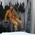
 Also, I loved how it wasn't at all explained how he switched to rock climbing shoes for the climbing scene and then back to boots afterward.